Last week I wrote about seeing the new bridges roll into Pioneer Park. I’ve since learned that they were not two bridges, but two halves of the same bridge. The Haines branch is wider than it looks. The only access to the new limestone trail on the other side is this bridge and the pedestrian suspension bridge. That bridge leads to the equally closed Ben Verley and Harrington trails, behind the south interpretive center and closed since mid April.
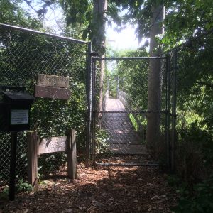
However, if you were out there looking for Pokemon on one of the last two Tuesday evenings, you would have gotten to go across with a guide, as they opened up the bridge for their event. Had I known about that ahead of time I might have tried posing as a hunter just to get a glimpse. We won’t have to wait much longer though, if construction stays on schedule. They say they plan to re-open the suspension bridge August 19. I don’t know if the new bridge will be open then as well or if that’s just when the heavy machinery will be out of there, which was the reason for the closure. We will then have a trail leading to the west edge of the park, but there it will stop for the time being.
Eventually, according to the http://prairiecorridor.org/home/trail-corridor/ website “The approximately 10 mile trail will meander along the Haines Branch of Salt Creek through the Prairie Corridor, beginning in Pioneers Park, extending southwest to loop through the Village of Denton, and ultimately connecting with the Spring Creek Prairie Audubon Center on the south end of the Corridor. From the Pioneers Park Nature Center, it will be about a 20-mile round-trip ride down to the Spring Creek Prairie Audubon Center. An additional 1½ segment will take riders west to the Conestoga Lake State Recreation Area. On the east end, the Prairie Corridor trail will connect to the City’s trail network via the Bison Trail.”

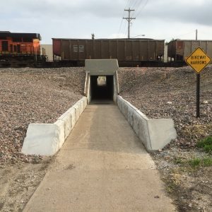
Currently they are at the land acquisition phase, which could take a long time. One of the obstacles will likely be railroad right of way, as they are notorious for holding up any crossing of railroad land with trails. Think of the Salt Creek levee trail under the tracks at J Street, we’re still waiting for it to follow the creek.
Using a rails-to-trails approach on an abandoned line is sometimes possible. That’s what much of Lincoln’s trail system consists of currently. The rest follows relatively inexpensive land along waterways. We would love to see the old Rock Island trail continue across Wilderness Park on it’s old trestles, but as far as I know without a large grant there is no funding for it. We can hope though, and with more people riding bikes we have more clout to show the need for more trails. Another reason to log those miles for Lincoln and the National Bike Challenge.