A couple of weeks ago I posted a link to videos about Epworth Park, now part of Wilderness Park. This week I’m re-posting the blog from two years ago where I talked about the park itself. The conditions are nearly identical, but the pandemic puts things in a different perspective. I don’t know if they closed down events there in 1918-19 or not. Exploring the remaining clues left behind of something so big that is nearly invisible just 100 years later is a good socially distanced outdoor activity. I walked through it with friends a few weeks ago and we found many traces, including the old sluice gate that let water into Epworth Lake, and some bridge abutments. Just west of the gateway along the road is the pipe in the shape of a large staple that helped form the line in front of the ticket booth. A dead give-away as to the location of the open air auditorium is the row of huge sycamore trees. They are not native this far north and rimmed the outside of the hall. There are also some large pine trees that mark it, the only ones in the area. If you’re riding through, take the trail leading out of the east end of the parking lot at First and Calvert streets. It will wind along the edge of Salt Creek then take you west toward Epworth Hall.
Trail Ramblings: If You Lived In And Around Lincoln 100 Years Ago.
POSTED ON BY JANINE COPPLE
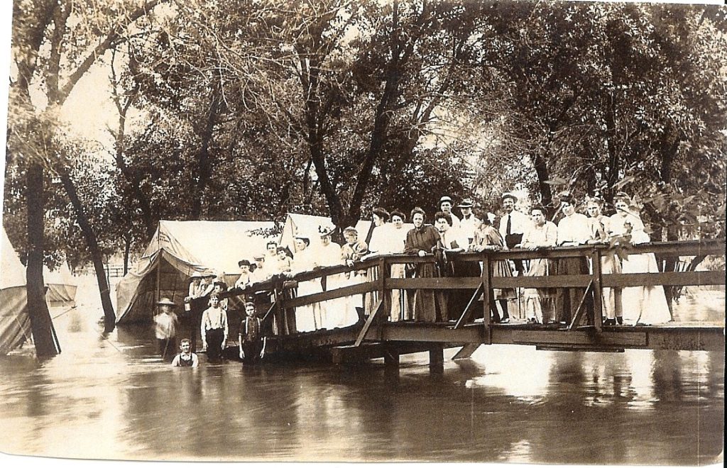
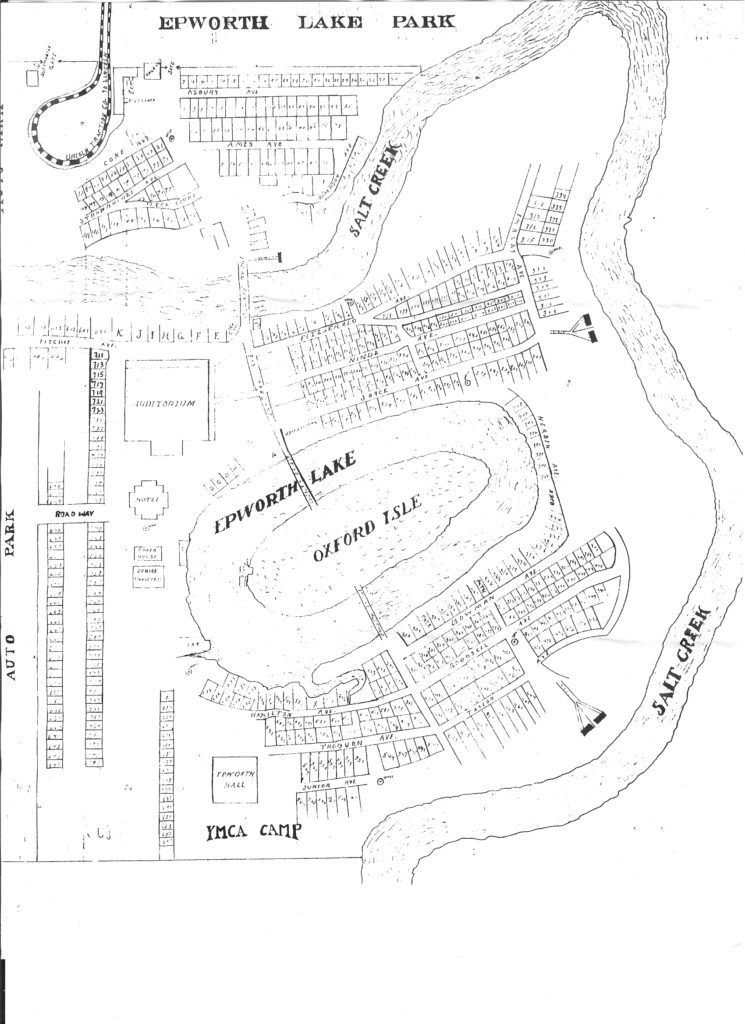
The snow has melted and it’s muddy now, but when it dries, and if you know where to look, you can still see traces of some camp buildings and features of the former Epworth Park, in Wilderness Park. It was a summer camp run by Methodists from the first years of the last century until 1935, when 10-14 inches of rain fell over six days. Sound familiar? In 2015 when the park flooded we lost use of the trails for a while and had to resurface the Jamaica North, but in 1935 there were no levees or area flood control dams. Hundreds of park structures were destroyed when the flood waters came through “like a giant eraser.” The entrance was near the arch at First and Calvert Streets. That was where the street car line from Havelock ended that my grandparents took after the buggy ride from their farm along the Rock Island Line.
The following images are courtesy of Jim McKee. He led an historical walk of Epworth Park in 2007, which I made into a video for The Friends of Wilderness Park.
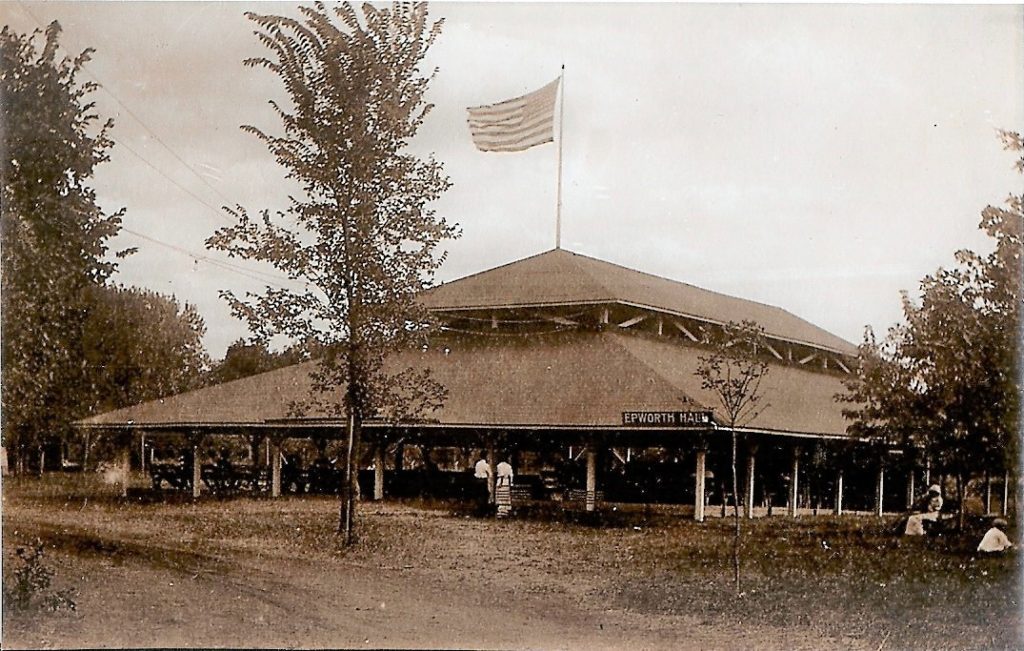
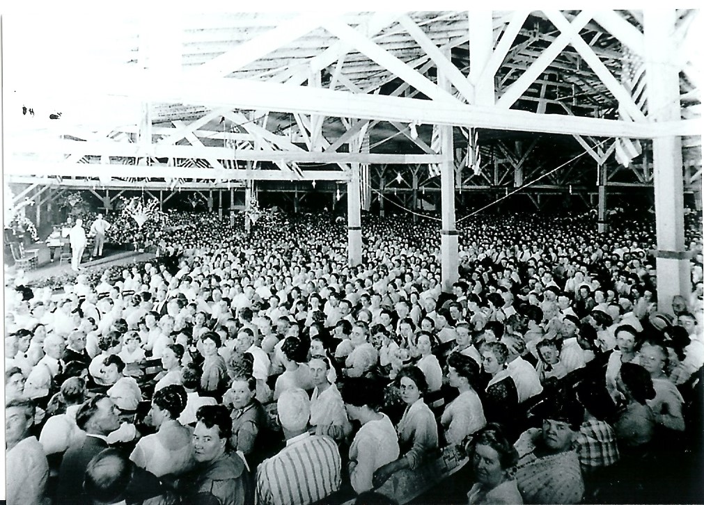
The area that was Epworth park isn’t ridden as much as other areas of the park, but with the leaves down, and if it isn’t too muddy, you might find the now giant Sycamores that framed the entrance to the outdoor auditorium that seated 5000. Park advertising from those days claimed it was the largest gathering place on the North American Continent. It is true that the most famous speakers and performers of the day appeared on it’s stage.
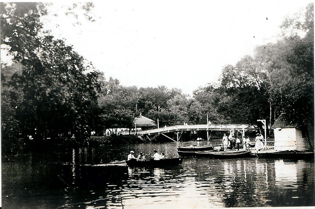
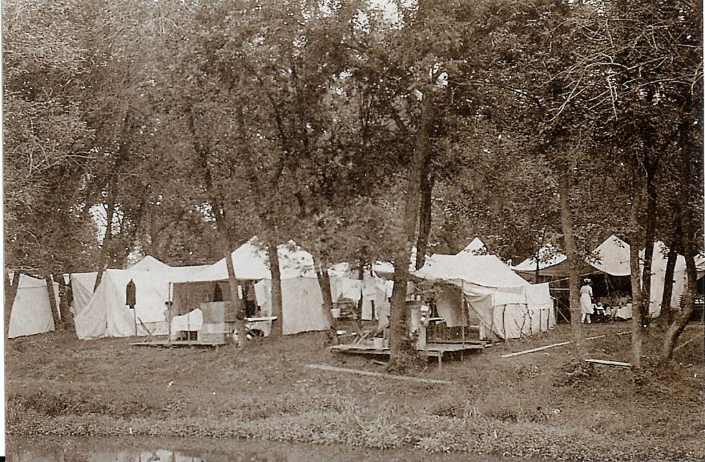
There existed a donut-shaped lake for boating, which is still visible as a depression, since the water was nine feet deep. There was a post office, bank, hotel, bakery, restaurants, and thousands of tent platforms among the structures. The streets have disappeared.
Today you can find an occasional stone or concrete pillar support, bridge abutment, well cover, or other random piece of the past, but not much more. Every year they are covered a little deeper in leaves, and the last flood may have completely covered some up or washed some into the creek.
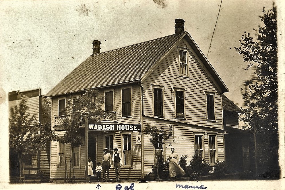
If my grandparents wanted to, they could also have taken a train from the old Missouri Pacific depot at 8th and “S” Street to Wabash, where my grandmother’s family ran the hotel. Next week I’ll talk about what you might see on that popular trail.
POSTED IN BLOGTAGGED WILDERNESS PARK